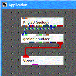
Instance geologic_surface from Processing sublibrary, and connect the tri-colored output port on Krig_3D_Geology to its matching input port.
Instance a Viewer and connect the red output of geologic_surface to create the following network.

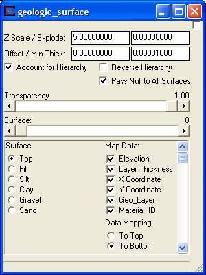
The Modules pull-down menu now has a pull-down command to access the user interface for Krig_3D_Geology and geologic_surface. Select geologic_surface and the following window should appear on your screen.

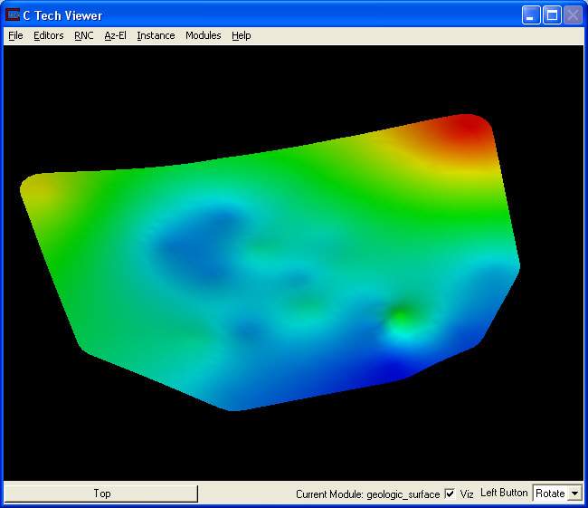
Click on Az-El on the Viewer menu and choose scale 1.10, Elevation 40 and 195 Azimuth to get a view of the Top Geologic Surface. This network will allow you to visualize any of the geologic surfaces and is useful for debugging geologic layer definitions and visualizing individual layer surfaces. It also provides a means to display other types of geologic surfaces such as water tables (which may vary over time). Use the slider, in the Geologic Surface module, to select from the six surfaces (0-5) for this model. Z Exaggeration allows you to magnify the z-coordinate and the Surface Z Offset provides a means to move surfaces. When looking at the first surface (Surface 0/Top), your Viewer should look like this.

By default surfaces will be colored (from blue to red) based on the variation in the z-coordinate (elevation) of the individual surface. By unchecking Elevation in the Map Data section, we can change how the surface is colored. The surface will always be colored by the first data component mapping through. When visualizing water tables or when no color (or a specific solid color) is wanted, uncheck all of the Map Data toggles. The color (and other properties) can be edited using the Object Selector and Object->Advanced Settings editor in the Viewer.
© 1994-2018 ctech.com