![]()
georeference_imagehas been superceded by a standalone utility programGeoreference Imagewhich can create world files or .gcp (ground control point) files for images.
General Module Function
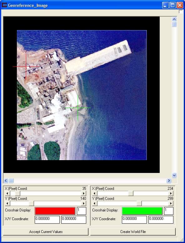
The georeference_image module (only available in EVS-PRO and MVS), provides a means to create a world file or directly georeferenced an orthorectified image. The process is straightforward. The users sets thepositionof two crosshairs to specify pixels with known x-y locations. Those locations are typed into the modules window. This information is used to determine the overall spatial extent of the image and thereby properly georeferenced the image.
Module Input Ports
georeference_image has one input port which should be an image from the Read_Image module.
Module Output Ports
georeference_image has one output port that should be connected directly to the texture_map module.

Module Control Panel
The control panel for georeference_image is shown in the figure above.
There are identical controls for two independent sliders (nominally red and green). The X (Pixel) Coord: and Y(Pixel) Coord: sliders set the positions of the crosshairs. The units here are in integer pixels. Color buttons allow the user to change the colors of the crosshairs if red or green is low contrast for your image.
Once the X/Y Coordinate values are typed in, the Accept Current Values button exports a georeferenced image from the output port.
© 1994-2018 ctech.com