
General Module Function
The combine_geology module is used to merge up to six geologic surface (per combine_geology module) to create a field representing multiple geologic layers.
The mesh (x-y coordinates) from the first input field, will be the mesh in the output. The input fields should have the same scale and origin, and number of nodes in order for the output data to have any meaning.
Module Input Ports
combine_geology has six input ports. The left port must always be used and any number of the others (from zero to five). The mesh present in the first input port is the one that is exported and the number of nodes in each input port used must match the first or an error will be reported. You cannot combine data from fields with different numbers of nodes. Also, be aware that combine_geology will not check to see that your coordinates or grids are identical, but it assumes that is the case.
Note: If you connect to an input port and then disconnect, the data components list will not be cleaned out. We recommend that you get a new module in this case.
Module Output Ports
combine_geology has three output ports.
Module Control Panel
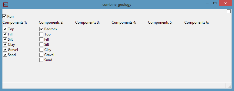
The control panel for combine_geology is shown in the figure above. Up to six columns of check boxes are displayed. The left column contains all of the data component fields passed to the first input port. Likewise, the other columns contain all of the data components passed to their input ports. A check in the box next to any of these data components indicates a component to be included in the output. By default, the first (0th) data component in each column is selected and all other data components are not selected. Components having the same nodal component label will cause the output to have multiple nodal component labels that are the same. For example, if geo_layer is present and selected in both data component columns, the output will have two geo_layer data component.
It also has a Run toggle (to prevent downstream modules from firing during input setting changes).
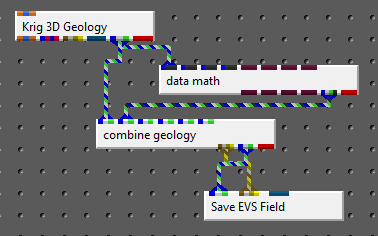
combine_geology provides an important ability to merge sets of surface or add additional surfaces to geologic models. It is important to understand the consequences of doing so and the steps that must be taken. The Brown-Grey-Light Brown-Beige port contains the material_ID numbers and names and it is important that the content of this port reflect the current set of surfaces/layers reflected in the geology. When Material_ID or Geo_Layer is presented in a Legend, this port is necessary to automatically provide the layer names. When combine_geology is used to construct modified geologic horizons, its Brown-Grey-Light Brown-Beige port MUST be used vs. the same port in Krig_3D_Geology such as in the application below:
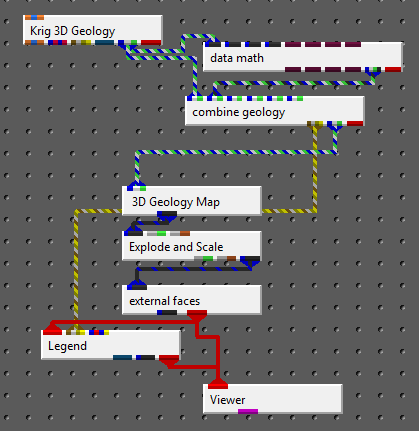
which creates the following output.
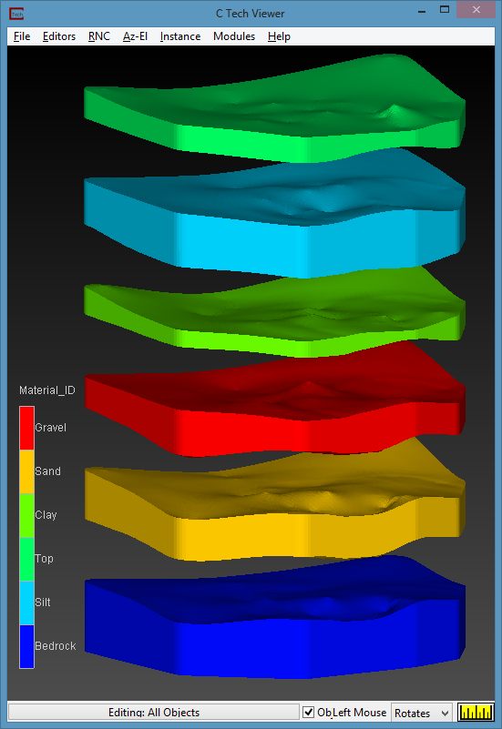
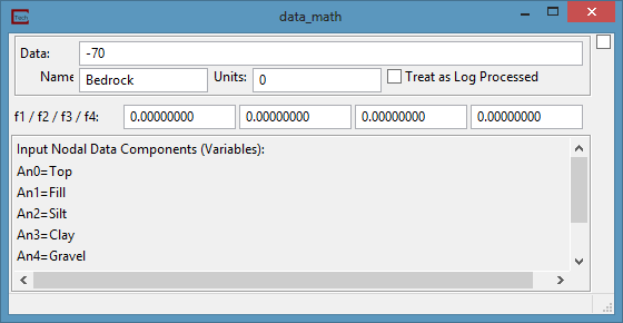
Please note that this is the standard dataset used throughout the workbooks, but now has a lower "Bedrock" layer which was created using data_math. Please note that Units must contain a number which corresponds to the Material_ID for this new surface (geologic horizon).
When Save_EVS_Field is used to save combined geology, you must connect the ports as shown:
© 1994-2018 ctech.com